Art of Soaring
Discover the Art of Soaring
Experience the challenge and satisfaction of engine-free flight! These workshops introduce the fundamentals of sailplane flying. From understanding the forces that keep a glider airborne to mastering launches, thermal soaring, and cross-country navigation, you will develop the skills to explore the skies using only the atmosphere’s energy.
Whether you’re completely new to gliding or looking to improve your soaring skills, this combines practical instruction, live demonstrations, and hands-on flying in a relaxed environment.
Part 1: Introduction to Sailplane Operations
Our first few sessions introduce the fundamentals of sailplane flight, including aircraft controls, cockpit instruments, launch procedures, and the basic principles of soaring. We will learn how gliders differ from powered aircraft, how to manage airspeed and altitude, and how to recognize the atmospheric conditions that make sustained flight possible.
Part 2: Guided Soaring Adventures
Following the instructional workshops, we will have an opportunity to apply these new skills during a series of organized group flights. These flights will introduce progressively more challenging soaring conditions, routes, and navigation objectives to build confidence while flying alongside fellow enthusiasts.
Each flight will emphasize practical techniques covered during training, including finding lift, managing energy, planning routes, and making sound decisions when conditions change. The goal isn’t simply to reach a destination, but to understand how to get there using the environment to your advantage.
No previous sailplane experience is required. A basic familiarity with MSFS 2020/2024 and aircraft controls is recommended. Our objective is to spend less time troubleshooting installations and more time enjoying the unique challenges of soaring.
As always, meet us on Discord for more event details.
What: Art of Soaring Workshops
When: Sundays, starting Nov 1st, 8am PT, 11am ET, 1600 UTC
Where: Discord
Additional Info: www.digitalthemepark.com
Art of Soaring • Session (1 of 2) • Orientation
Welcome to Grenoble, France, where the dramatic cliffs and ridges of the French Alps offer a spectacular introduction to ridge soaring
Time to build a foundation for our weekly soaring flights. We’ll cover glider selection, variometers and LX flight computers, finding and using lift, managing your glider in flight, and planning a safe landing.
- When: Sunday, November 1
- Time: 8 AM PT • 11 AM ET • 16:00 UTC (duration 60 min)
- Departure: LFLG (Grenoble, France) • RWY 04L (grass)
- Required Utility
- B21 Logger – Load soaring flight plans
- Soaring Weather – Soaring Weather by Sim Soaring Club (SSC)
- Suggested Utilities
- SSC Tracker – Track your flight, view your flight plan & log your progress
- B21 Task Planner – View, edit, and create flight plans
- Suggested Gliders
- Got Friends Discus-2C Standard – An excellent freeware glider
- Schleicher K7 – A slow, forgiving training glider for beginners.
- Jonker JS3-18 – Not for beginners. This complex racing glider has flaps and is best suited to experienced glider pilots. A great freeware alternative to the Got Friends AS-33.
- Control Bindings
- Elevator, ailerons, and rudder
- Landing gear
- Trim axis and spoilers
- Tow cable release
- Weather:
- Preset: SSC3 070 Scattered Clouds 6k E 15kt
- Turbulence: Low or Medium
- In-sim time: July 1 at 12 PM (local)
- Temperature: +90°F
- Tow Plane: Select the Wilga(flyable) instead of the default tow plane or winch.
- Session Instructions:
- When instructed, start on the runway, take off, climb, and release the tow.
- Alternatively, use slew mode to position your glider at altitude after spawning, then enter Active Pause.
- We’ll discuss each concept, then unpause to practice it.
Orientation to Gliders • Session (2 of 2) • Ridge Lift
Continue building a foundation for our weekly soaring flights. This session focuses on finding and using ridge lift, following terrain, managing altitude, and planning your return and landing.
- When: Sunday, November 8
- Time: 8 AM PT • 11 AM ET • 16:00 UTC (duration 60 min)
- Departure: LFLG (Grenoble, France) • RWY 04L (grass)
- Flight Plan: Orientation – Le Versoud (LFLG) to Le Versoud (LFLG)
- Weather:
- Preset: SSC3 070 Scattered Clouds 6k E 15kt
- Turbulence: Low or Medium
- In-sim time: July 1 at 1 PM (local)
- Temperature: +90°F
- Session Instructions:
- When instructed, take off, climb, and release the tow. Glide toward the cliffs northwest of the airport, then turn northeast.
- Use ridge lift to climb alongside the cliffs to the benchland above. Continue northeast across the bench, climbing along the higher ridges toward Pontcharra/Barraux.
- Turn southwest and follow the ridges back toward Grenoble, staying on the windward side and slightly above the ridgelines.
- Return to LFLG and land on runway 04L (grass).
Catamarca • Adventure 1 • Hunting Thermals
Welcome to Catamarca, Argentina, where dry valleys and rugged Andean foothills set the stage for our first soaring adventure.
This session focuses on finding thermals, managing altitude between waypoints, and combining thermal and ridge lift on a cross-country flight.
- When: Sunday, November 15
- Time: 8 AM PT • 11 AM ET • 16:00 UTC (duration 90-120 min)
- Departure: SANC (Catamarca, Argentina) • RWY 02
- Flight Plan: Adventure 1 – SSC AR Catamarca (Griphos)
- Weather:
- Preset: SSC 346 High Cu T12-16 W10 – 24v2
- Turbulence: Low or Medium
- In-sim time: January 21 at 1 PM (local)
- Session Instructions:
- When instructed, take off and find a thermal to reach the 5,000 ft start altitude. The ridge east of the airport also rises to about 5,000 ft and may provide useful lift.
- Work the thermals toward WP1 to build altitude. Around 7,000 ft should be enough to reach WP2, where you should arrive near ridge height. Fly accurately through WP2.
- At WP2, follow the ridge north toward WP3. Look for the strongest lift where thermals meet the windward side of the ridge.
- Continue through WP4 and follow the ridge to the finish. With good speed and lift, this final leg can take less than 10 minutes.

Coff’s Harbor • Adventure 2 • Thermalling Cross-Country
Welcome to Coffs Harbour, Australia, where the New South Wales coast meets green hills and rugged hinterland.
This session focuses on linking thermals, managing speed and altitude between climbs, and using ridge lift for the final leg home.
- When: Sunday, November 22
- Time: 8 AM PT • 11 AM ET • 16:00 UTC (duration 90-120 min)
- Departure: YCFS (Coffs Harbour, Australia) • RWY 21
- Flight Plan: Adventure 2 – SSC AU Coffs Harbour 140
- Weather:
- Preset: SSC 089 Low Cu T4-8 W5 – 24v2
- Turbulence: Low or Medium
- In-sim time: January 28 at 1 PM (local)
- Session Instructions:
- When instructed, take off and catch a thermal to gain enough altitude for a good start. Alternatively, use slew mode to position your glider at altitude.
- Fly the first 60 miles toward WP3 using thermals. Keep cruising speeds modest and take available climbs to maintain enough altitude for the next leg.
- At WP3, transition to ridge lift and follow the ridge for the final 25 miles home.
Nelson Lakes • Adventure 3 • Ridge Flying Cross-Country
Welcome to Nelson Lakes, New Zealand, where mountain ridges and deep valleys set the stage for a South Island soaring adventure.
This session focuses on following windward ridges, managing altitude across valleys, and using thermals to prepare for the final glide home.
- When: Sunday, November 29
- Time: 8 AM PT • 11 AM ET • 16:00 UTC (duration 90-120 min)
- Departure: NZLE (Nelson Lakes, New Zealand) • RWY 29
- Flight Plan: Adventure 3 – SSC NZ Nelson Lakes NW (Griphos)
- Weather:
- Preset: SSC 223 High Cu T4-8 NW15 – 24v2
- Turbulence: Low or Medium
- In-sim time: May 30 at 1 PM (local)
- Session Instructions:
- When instructed, use ridge lift or find a thermal to reach the 5,000 ft start altitude.
- Follow the ridges toward WP1, staying on the windward side.
- After crossing the ridge, glide along the valley toward WP2. Look for thermals on the way to WP2 or WP3 to build altitude for the final leg. If you get too low, WP2 is an alternate airport.
- Choose a route over the final low ridges, staying on the windward side where possible. Manage your altitude for the glide home, then enter a left downwind for runway 29.
Puimoisson • Adventure Flight 4 • Learning to Glide Efficiently
Welcome to Puimoisson, France, where the hills of Provence meet the foothills of the Alps for another soaring adventure.
This session focuses on using ridge lift efficiently, managing altitude into a headwind, and judging when you have enough height to glide home.
- When: Sunday, December 6
- Time: 8 AM PT • 11 AM ET • 16:00 UTC (duration 90 min)
- Departure: LFTP (Puimoisson, France) • RWY 25
- Flight Plan: Adventure 4 – FR Puimoisson 283
- Weather:
- Preset: SSC 283 High Cu T8-12 W15 – 24v2
- Turbulence: Low or Medium
- In-sim time: April 1 at 1 PM (local)
- Session Instructions:
- When instructed, take off and use the nearby ridges to gain enough altitude for the start.
- Follow the ridges toward WP1 and WP2, using windward slopes to maintain altitude.
- From WP2, head toward WP3 into the wind. Look for lift along the way and manage your speed and altitude carefully.
- Assess your altitude for the final glide home. If you need more height, use the ridges east of the flight plan or find a thermal before continuing to the finish.
Mammoth/Yosemite • Adventure Flight 5 • Finding and Following the Right Ridges
Welcome to Mammoth Lakes, California, where the Sierra Nevada’s towering peaks and rugged ridges set the stage for a high-altitude soaring adventure.
This session focuses on choosing effective ridge routes, maintaining altitude through mountainous terrain, and avoiding lee-side sink on the glide home.
- When: Sunday, December 13
- Time: 8 AM PT • 11 AM ET • 16:00 UTC (duration 120 min)
- Departure: KMMH (Mammoth Yosemite Airport, California) • RWY 27
- Flight Plan: Adventure 5 – SSC Mammoth Yosemite 311 (Griphos)
- Weather:
- Preset: SSC 311 High Cu T10-14 SW15 – 24v2
- Turbulence: Low or Medium
- In-sim time: October 14 at 1 PM (local)
- Session Instructions:
- When instructed, take off and use the ridges south of the airfield or a nearby thermal to gain altitude. Observe the maximum start altitude of 11,000 ft, then glide toward WP1.
- On the long second leg, choose a route through the high mountains using ridges on both sides of the flight plan. Use the strong ridge lift to reach WP2 with enough altitude.
- After WP2, turn and follow the ridge to maintain enough height for the glide home. Watch for sink on the lee side of the mountains.
- If you need additional lift, look for thermals beneath clouds in the valley. Use this valley route as an alternative for the return to the airport.
Bomoen • Adventure Flight 6 • Ridge Soaring Without Ridges
Welcome to Bomoen, Norway, where picturesque fjords and surrounding mountains set the stage for a round-trip soaring adventure.
This session focuses on finding ridge lift without obvious ridgelines, staying on the windward side of the mountains, and managing altitude through valley crossings for the glide home.
- When: Sunday, December 20
- Time: 8 AM PT • 11 AM ET • 16:00 UTC (duration 90 min)
- Departure: ENBM (Bomoen, Norway) • RWY 27
- Flight Plan: Adventure 6 – NO Bomoen 083
- Weather:
- Preset: SSC 083 Low Cu T4-8 S15 – 24v2
- Turbulence: Low or Medium
- In-sim time: July 15 at 3 PM (local)
- Session Instructions:
- When instructed, take off and use thermals or ridge lift to reach start height. Follow the fjord toward WP1, using your starting altitude and lift along the windward mountain slopes.
- After WP1, cross the valley toward the east side of the ridge and continue to WP2. Look for windward slopes to guide your route where there is no obvious ridgeline.
- Use the lift around WP3 to build altitude, aiming to pass WP4 above 2,500 ft.
- From WP4, follow the descending route home, managing your altitude for the return and landing.

Matsumoto • Adventure Flight 7 • Winter Mountaineering
Welcome to Matsumoto, Japan, where forested slopes and snow-covered peaks set the stage for a winter soaring adventure in the Japanese Alps.
This session focuses on choosing effective ridge routes in challenging conditions, adapting when lift is weak, and maintaining altitude toward high mountain waypoints.
- When: Sunday, December 27
- Time: 8 AM PT • 11 AM ET • 16:00 UTC (duration approximately 100 min)
- Departure: RJAF (Matsumoto, Japan) • RWY 18
- Flight Plan: Adventure 7 – SSC Matsumoto 080
- Weather:
- Preset: SSC 080 Low Cu T4-8 SE20 – 24v2
- Turbulence: Low or Medium
- In-sim time: February 25 at 1 PM (local)
- Session Instructions:
- When instructed, take off and gain altitude for the start, observing the maximum start altitude of 7,000 ft.
- Choose ridges carefully to climb toward WP1. If a slope isn’t providing enough lift, move out into the valley and try another ridge.
- After WP1, follow the mountaintops and ridges north toward WP2. Keep building and conserving altitude, as WP2 sits high in the mountains.
- Choose ridges carefully to climb toward WP1. If a slope isn’t providing enough lift, move out into the valley and try another ridge.
- After WP1, follow the mountaintops and ridges north toward WP2. Keep building and conserving altitude, as WP2 sits high in the mountains.
- After reaching WP2, follow the ridge south toward the finish, managing your altitude for the return and landing.
Lake Tahoe • Adventure Flight 8 • Putting It All Together
Welcome to the Lake Tahoe region, where the Sierra Nevada’s high ridges and mountain valleys set the stage for a flight that brings our soaring skills together.
This session focuses on linking ridge lift, building altitude for crossings, and planning a route through high terrain before the final glide home.
- When: Sunday, January 3, 2027
- Time: 8 AM PT • 11 AM ET • 16:00 UTC (duration approximately 120 min)
- Departure: KMEV (Minden–Tahoe, Nevada) • RWY 12
- Flight Plan: Adventure 8 – SSC Lake Tahoe 190 E
- Weather:
- Preset: SSC3 070 Scattered Clouds 6k E 15kt
- Turbulence: Low or Medium
- In-sim time: September 24 at 1 PM (local)
- Session Instructions:
- When instructed, take off and reach the 8,000 ft start altitude. If the tow leaves you short, use ridge lift to gain the remaining height.
- Follow the ridges through WP1 and WP2, building enough altitude for the crossing from WP2 to WP3.
- Continue through WP4 and climb toward WP5, the route’s highest point at 9,711 ft. Arrive with enough altitude to continue through the high valley toward WP6.
- Follow the valley to WP6, then manage your altitude for the final glide home and landing.
- Continue through WP4 and climb toward WP5, the route’s highest point at 9,711 ft. Arrive with enough altitude to continue through the high valley toward WP6.
- Follow the valley to WP6, then manage your altitude for the final glide home and landing.
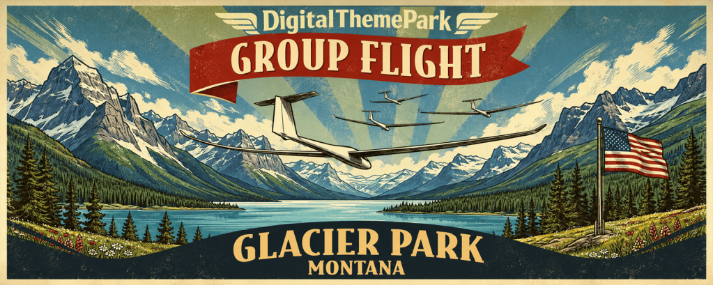
Glacier Park • Adventure Flight 9 • Soaring Over the Top
Welcome to Glacier National Park, Montana, where rugged peaks and deep valleys provide a spectacular setting for a summer soaring adventure.
This session focuses on combining ridge and thermal lift, gaining altitude for mountain crossings, and planning a one-way flight into Saint Mary Valley.
- When: Sunday, January 10, 2027
- Time: 8 AM PT • 11 AM ET • 16:00 UTC (duration approximately 90 min)
- Departure: 8U4 (Spotted Bear USFS, Montana) • RWY 32
- Flight Plan: Adventure 9 – Glacier Park (Griphos)
- Weather:
- Preset: SSC 282 High Cu T8-12 W10 – 24v2
- Turbulence: Low or Medium
- In-sim time: July 1 at 1 PM (local)
- Session Instructions:
- When instructed, take off and use ridge lift or thermals to gain altitude before the start. This is a one-way flight across Glacier National Park.
- Follow the ridge north toward WP1, climbing higher along the ridge as conditions allow. Look for stronger lift near the top.
- Cross the valley toward WP2, using the windward slopes of the high mountains to gain enough altitude for the crossing into Saint Mary Valley.
- Use thermals for additional altitude as needed; the expected cloud base is around 10,000 ft AGL. Continue down the valley and prepare to land at the destination airport on the Blackfeet Reservation.

Eureka • Adventure Flight 10 • Wave Soaring
Welcome to Eureka, Nevada, where desert valleys and mountain ridges set the stage for a high-altitude wave soaring adventure.
This session focuses on transitioning from ridge lift into simulated mountain wave, tracking altitude above terrain, and climbing toward 25,000 ft before returning to land.
- When: Sunday, January 17, 2027
- Time: 8 AM PT • 11 AM ET • 16:00 UTC (duration 45–90 min)
- Departure: 05U (Eureka, Nevada) • RWY 36
- Flight Plan: Adventure 10 – SSC Wave Tutorial
- Weather:
- Preset: SSC Wave
- Turbulence: Low or Medium
- In-sim time: July 1 at 12 PM (local)
- Session Instructions:
- When instructed, take off, release the tow, and cross the start. There is no maximum start altitude. Follow the ridge toward Diamond Peak, reaching the waypoint at or above 12,000 ft MSL.
- Continue into the lee toward Lower Wave Entry, which requires at least 11,500 ft MSL. As you approach roughly 6,000 ft AGL, watch for the preset’s wind reversal, increasing wind speed, and wave lift.
- Follow the low ridges, staying above approximately 5,500 ft AGL. At the smoother northern ridge, climb using figure-eight patterns or by pointing into the wind. Stay above 6,000 ft AGL as you work toward 20,000 ft MSL.
- Head toward the plain and Upper Wave Entry, which requires at least 19,500 ft MSL. Reach 13,000 ft AGL to enter the upper wave, then follow the lower ridges while maintaining that height above terrain.
- Use the smooth ridge area to continue climbing toward 25,000 ft MSL, staying above 13,000 ft AGL to maintain wave lift. Then return to Eureka and land.
Categories

